

▼ Latest
Geoguessr
Free mode
100% free
Freemium
Free Trial
Featured matches
-
 Tatiana Paniushkina🙏 144 karmaOct 29, 2024@Learn EarthLove it! So far it looks like a hybrid of educative.io (path, text format, practice with mistakes correction after) duolingo (on the practice part) based on the user experience and I personally like both
 -
 Didn't even get the country right. The place looked nothing like the location on my image. :/
 -
-
-
-


Verified tools
-
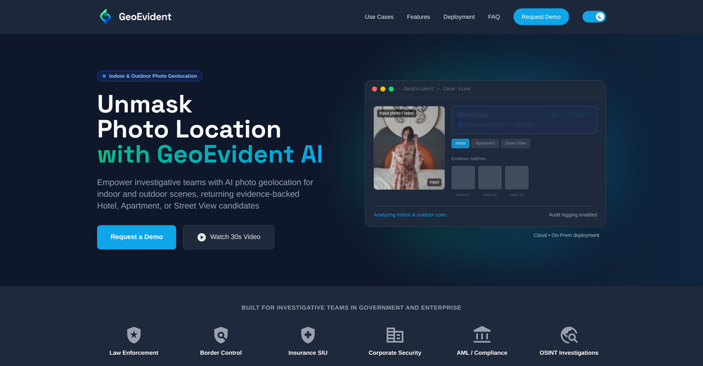
This thing is actually insane. I uploaded a picture from a random hike I did years ago, and it guessed the location exactly. Not just the country but the exact trail. I have no idea how it works, but its pretty impressive.
-
Eh it's ok. You only get one question to test it out and the quality of the info you get in that one message is too lackluster to warrant going back for more, especially if you're into astrology and already know basic stuff. The aesthetic is fine. Some of the buttons are inexplicably disabled and the tooltips conflict with one another on the map, making it irritating to try to interact with the lines rendered on the map.
-
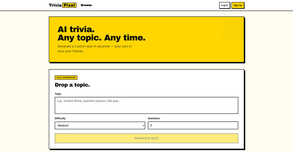
Hands down the best AI powered question generator out there. High quality questions, easy to use and very easy to share quizzes.
- Sponsor
 Rocket - Think it. Type it. Launch it.
 -
Im a student, the app helped me on quizzes and homework so much faster. the QuickSnap feature is amazing for math problems. Plus, the free version offers so much! Definitely recommend this to any student wanting to make study time easier.


Other tools
-
I tried other tools aswell, this was the only accurate. Other ais didn't even get the country right. Compared to the others it had the advantage that I could specify the area in which the location was. I only tried it once so far but I am satisfied.
-
was good but no longer accessible in there own words "available exclusively to qualified law enforcement agencies, enterprise users and government entities"
-
Google Earth AI embraces a plethora of tasks. It helps in visualizing geographic data, guides in making advanced data mapping, and supports in 3D earth modeling. It also provides a platform for location-based services and remote sensing, while incorporating satellite imagery for detailed geospatial analysis.
-
- Didn't find the AI you were looking for?


Post


