Go to section
Spotlight![]() SureThing.io - "OpenClaw" for BeginnersTask automation
SureThing.io - "OpenClaw" for BeginnersTask automation
The front page of AI.Used by 90M+ humans.

Generate image
Tasks
Generate text
Free mode
Trending
Leaderboard
Characters
 Mini tools
New
Featured
Lists
Agents
Requests
Jobs
Map
Newsletter
Starter pack
Free tools
Speech to text
Text translator
Remove background
Settings
Edit profile
My tools
Gallery
Dashboard
Inbox
Get featured
Contact TAAFT
For you
Popular
Job impact index
Most saved
Affiliate program
Submit AI tool
Notification preferences
Glossary
Home
Timeline
My profile
Create tool
Deals
Companies
Models
Robots
Papers
Fundraises
Devices
Organizations
Events
Prompt Pack
Merchendise
APIs
Features
Tools
Countries
Collections
Videos
News
Investors
Repositories
Mini tools
New
Featured
Lists
Agents
Requests
Jobs
Map
Newsletter
Starter pack
Free tools
Speech to text
Text translator
Remove background
Settings
Edit profile
My tools
Gallery
Dashboard
Inbox
Get featured
Contact TAAFT
For you
Popular
Job impact index
Most saved
Affiliate program
Submit AI tool
Notification preferences
Glossary
Home
Timeline
My profile
Create tool
Deals
Companies
Models
Robots
Papers
Fundraises
Devices
Organizations
Events
Prompt Pack
Merchendise
APIs
Features
Tools
Countries
Collections
Videos
News
Investors
Repositories

▼ Latest
Geographical data
Free mode
100% free
Freemium
Free Trial
Featured matches
-
-

Docker Catalog is now available for Hostinger VPS users.
You can choose from hundreds of ready-to-deploy apps across categories like AI/ML, automation, databases, developer tools, media, observability, and utilities.
Each app is packaged to run in Docker, helping you set up projects faster and keep deployments consistent. Pick an app, deploy it, and manage it from Docker Manager in hPanel.
For selected apps on new VPS setups, HTTPS is configured automatically through Traefik, so there’s no need to set up Certbot or SSL manually.
-

 J.I.🛠️ 1 tool 🙏 142 karmaFeb 28, 2026@DailyScope.aiGreat tool for learning about the latest primarily in geo-politics it seems. Seems to be fairly balanced. Also made a video on it https://www.youtube.com/watch?v=MsIADCoir5w
 -
-
-
 At first, I underestimated this tool. Now I can easily see its real power for beginners or entrepreneurs.
 -
 Open
Open Great tool! Found me super niche influencers pretty quickly!


Verified tools
-
Reverse engineered a competitor's entire funnel with this. found their exact ad copy, landing pages, and targeting angles. used those insights to rebuild our campaign strategy and ROAS jumped 60% in two weeks.
-
This thing is actually insane. I uploaded a picture from a random hike I did years ago, and it guessed the location exactly. Not just the country but the exact trail. I have no idea how it works, but its pretty impressive.
- Spotlight
 SureThing.io - "OpenClaw" for BeginnersTask automation
 -
Eh it's ok. You only get one question to test it out and the quality of the info you get in that one message is too lackluster to warrant going back for more, especially if you're into astrology and already know basic stuff. The aesthetic is fine. Some of the buttons are inexplicably disabled and the tooltips conflict with one another on the map, making it irritating to try to interact with the lines rendered on the map.
-
People who use location as source for their main data, it is very good product foe them.
-
Data narration and augmentation are valuable tools from datumfuse.ai


Other tools
-
was good but no longer accessible in there own words "available exclusively to qualified law enforcement agencies, enterprise users and government entities"
-
I tried other tools aswell, this was the only accurate. Other ais didn't even get the country right. Compared to the others it had the advantage that I could specify the area in which the location was. I only tried it once so far but I am satisfied.
-
-
-
- Didn't find the AI you were looking for?
-
Google Earth AI embraces a plethora of tasks. It helps in visualizing geographic data, guides in making advanced data mapping, and supports in 3D earth modeling. It also provides a platform for location-based services and remote sensing, while incorporating satellite imagery for detailed geospatial analysis.
-
 Generate ultra-realistic satellite images with professional detail.Open
 -
It literally told me it couldn’t create maps, and directed me to Mapbox.
-
 Especialista em Ciência e Tecnologia de AlimentosOpen
 -
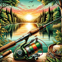 Your expert guide in all things fishing.Open
 -
 Generates queries to extract data from OpenStreetMap.Open


