

▼ Latest
Geographical coordination
Free mode
100% free
Freemium
Free Trial
Featured matches
-
1,70813Released 1mo agoFree + from $58.61/mo
 L Sz🙏 27 karmaOct 12, 2025@GeoInferDidn't even get the country right. The place looked nothing like the location on my image. :/
 -
2125Released 18d agoNo pricing

Verified tools
-
18,86417v1.1 released 4mo agoNo pricing
-
5,25950Released 5mo agoFree + from $5This thing is actually insane. I uploaded a picture from a random hike I did years ago, and it guessed the location exactly. Not just the country but the exact trail. I have no idea how it works, but its pretty impressive.
-
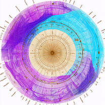 Discover your cosmic connections worldwide through astrocartography.Open7606Released 2mo agoFree + from $9.9Eh it's ok. You only get one question to test it out and the quality of the info you get in that one message is too lackluster to warrant going back for more, especially if you're into astrology and already know basic stuff. The aesthetic is fine. Some of the buttons are inexplicably disabled and the tooltips conflict with one another on the map, making it irritating to try to interact with the lines rendered on the map.
 -
6,860155Released 2y agoFree + from $10/mo
- Spotlight: ModelRed (AI security)
-
5,92671Released 2y agoFree + from $9/moPeople who use location as source for their main data, it is very good product foe them.


Other tools
-
7701Released 1y ago100% Free
-
2,25018Released 1y agoFree + from $10.63/moI tried other tools aswell, this was the only accurate. Other ais didn't even get the country right. Compared to the others it had the advantage that I could specify the area in which the location was. I only tried it once so far but I am satisfied.
-
12,54774Released 1y agoNo pricingwas good but no longer accessible in there own words "available exclusively to qualified law enforcement agencies, enterprise users and government entities"
-
15,13420Released 18d ago100% FreeGoogle Earth AI embraces a plethora of tasks. It helps in visualizing geographic data, guides in making advanced data mapping, and supports in 3D earth modeling. It also provides a platform for location-based services and remote sensing, while incorporating satellite imagery for detailed geospatial analysis.
-
8278Released 2y agoNo pricing
-
3,45811Released 3y agoFree + from $99/mo
-
346Released 1y ago100% Free
-
5626Released 1y agoFree + from $6.52
-
8305Released 2y agoFree + from $55.19/mo
-
1,3999Released 3y agoNo pricing
-
2,83627Released 2y agoNo pricing
-
7707Released 2y agoNo pricing
- Didn't find the AI you were looking for?
-
1,79710Released 1y agoFree + from $5.99/mo
-
 Simplify autonomy for off-highway vehiclesOpen1,6567Released 3y agoNo pricing
 -
27,627134Released 2y ago100% Free
-
1,6656Released 2y ago100% Free
-
2,6939Released 2y ago100% Free
-
1,9024Released 2y agoFree + from $12/mo
-
1,4327Released 3y agoNo pricing
-
4738Released 2y agoFree + from $0.05
-
3118Released 1y agoNo pricing
-
7926Released 2y agoFree + from $100/mo


Post


